
Scotch Plains Street Directory: Start with the Address
The address workflow is deliberately layered. USPS gives a delivery-formatted address, the state property system ties that location to a parcel, and Union County mapping supplies geometry and identifiers. The tax record can identify an assessed owner and a tax-year snapshot. From there, the Union County Clerk’s name-keyed land index can lead to deeds. Historical address directories and an appropriately limited voter route are separate evidence, not replacements for a parcel or recorded instrument.
- Enter the complete address in the USPS ZIP Lookup, retaining any directional, suffix, unit, municipality, and ZIP correction it returns. The result establishes postal formatting and deliverability, not occupancy.
- Search the normalized location in the New Jersey Property Explorer. Save the municipality, block, lot, qualification, owner field, property location, and annual-data year.
- Check the parcel’s shape and identifiers in the Union County layer. Its display field is Location, while OBJECTID and PAMS_PIN make useful map-to-record bridges.
- Use the assessed owner as the entry point to the Union County Clerk land index. Search deed records by party name, then compare the deed’s legal description with the parcel before connecting it to the street number.
- For a dated household clue, consult an address section in an edition-specific directory or request the relevant record from its custodian. Treat historic entries and single-person registration checks as time-stamped evidence rather than a current block list.
That sequence prevents a common error: reading a postal match, a tax mailing address, or a name hit as though it established the same fact. The strongest handoff has matching situs, block and lot, legal description, and source dates.
Scotch Plains Street Directory Property Search Fields
NJ Property Explorer is the public address-to-parcel bridge for a street search. It accepts location or owner searches and supports county, municipality, block, and lot filtering. The municipal assessor maintains property record cards and tax maps, but the assessor page does not present a dedicated public owner or address form. When a result matters, request the card by exact situs address, owner, or block and lot and retain its assessment year.
| Search field or result | How it helps a street search | Important limit |
|---|---|---|
| Location / address | Finds the mapped parcel tied to the normalized street string. | A corner or multi-unit parcel can carry a label different from a postal address. |
| County and municipality | Limits the result to Union County and Scotch Plains. | A block or lot alone is not a safe key across municipalities. |
| Block, lot, qualification | Connects tax data, GIS geometry, and a deed’s legal description. | Verify all three together before making a title connection. |
| Owner and property location | Supplies the assessed-owner and situs labels for the annual record. | An owner field does not establish present occupancy. |
| Land value, building value, prior tax, classification | Places the parcel in a dated tax context. | Annual filing can lag a transfer or physical change. |
See the state Property Explorer entry point before beginning the parcel step.
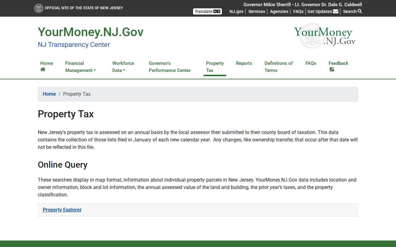
Use the explorer as an annual property record, then write down the source date alongside the returned location and block-and-lot identifiers. Scotch Plains assessment values are set as of October 1 of the prior year, so a later deed can appear after the annual property data used by the explorer.
A careful card request asks for the owner, situs, mailing address, block, lot, qualification, land and building assessments, classification, exemption fields, assessment date, sketch, and tax-map reference. Those fields have different evidentiary value. A senior, disabled, or veteran exemption is tax context rather than proof of a person’s presence at the property. A building-value change can suggest that work occurred, but the permit record and final inspection status are the better documents for dating construction. For a quality check, compare the property result, parcel geometry, and deed image using the owner name, parcel identifier, situs, and legal description. A matching street string by itself is weak evidence, especially where a number is reused or a record predates current numbering.
Scotch Plains Street Records by Address Key
Each address-oriented source answers a narrower question. USPS is a delivery source. A tax card is an assessment source. GIS is a spatial source. A recorded deed is a document source. Keeping the labels separate helps a street directory preserve useful distinctions rather than turn every record into a claim about the current household.
| Address record | Custodian or route | What it can establish | Access path |
|---|---|---|---|
| USPS address result | USPS ZIP Lookup | Standardized street, city, state, ZIP, and possible ZIP+4 | Free address lookup; not identity evidence |
| Property explorer result | New Jersey annual property data | Owner, location, block/lot, annual values, prior tax, classification | Free state explorer; dated annual data |
| Property record card | Scotch Plains Tax Assessor | Situs, owner, mailing clue, tax-map details, assessment fields | Municipal request; public online form not located |
| Parcel geometry | Union County parcel layer / NJGIN | Location, OBJECTID, PAMS_PIN, mapped parcel relationship | Free GIS service; not a certified title record |
| Recorded land documents | Union County Clerk | Grantor/grantee, instrument, date, book/page, image, legal description | Free name index; Record Room land transactions from 1857 forward |
| Permit history | Scotch Plains Building/Zoning | Address-linked project, applicant, date, and inspection context | Address-specific request; no public searchable index located |
| Historic address directory | Library and regional collections | Edition-specific occupants, address entries, and abbreviations | Library or collection access; not a continuous modern roll |
For a property card, owner, situs, mailing address, block, lot, qualification, assessment date, classification, and any sketch or tax-map reference should be copied as distinct fields. A mailing address can be a post-office box or a different place entirely. The township’s tax collection portal may reprint a bill or show account context, but it is a payment tool, not a street directory.
The municipal assessor’s listed address is 430 Park Avenue, and the office works under the Union County Board of Taxation and state director. The assessor maintains property record cards by owner and township tax map, processes permit-added assessments, and determines taxability rather than the tax rate. If a street query requires a record not shown online, the municipal-card route is the documented alternative; an OPRA request should identify the exact address and seek the non-exempt portion of the records held by the right custodian.
Scotch Plains Street Geography and Number Ranges
Parcel geometry is the useful organizing spine for a named street. In the Union County parcel layer, Location is the display label and PAMS_PIN or OBJECTID can be preserved with the parcel shape. That approach is more reliable than assuming adjacent numbers share a record, especially near corners, private drives, or parcels whose legal descriptions outlast a familiar street label.
The Union County street list adds a separate geography: municipality, street, low and high number, side, ZIP, ward, and district. Its displayed Jersey Avenue example places the east-side range 2044–2306 in 07076. The PDF’s coverage date was not located, so it is evidence of how a range is encoded, not a current polling assignment. Current election routing belongs with the Union County where-to-vote service.
This street geography is useful for civic and family-history research because it makes the source’s unit of description visible: one source may use a number span, another a parcel polygon, and another a ward or district. Record the map or list date before comparing them.
Scotch Plains Street Directory Deed-Chain Route
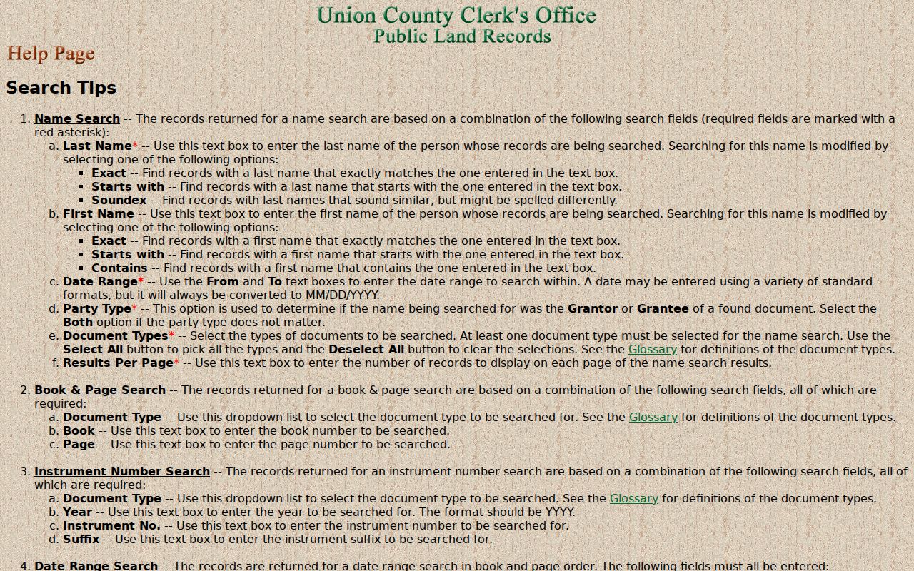
The County Clerk does not index deeds by street address. Its own guidance sends an address researcher to tax-board information to identify the owner, then back to the land index. In the name-search form, the surname, date range, party type, document type, and match options matter. Search the current owner as a grantee in Deed records, save the recorded date, instrument number, book/page, and legal description, then test the seller as a prior grantee for the next step backward.
The Clerk’s search-help page explains the name, date, book/page, and instrument routes that become useful when a reference is already known.
The index was inspected through August 25, 2026, while the County Clerk Record Room reports land transactions from 1857 to the present. Images before January 1986 remain in processing online, so an older name result without an image calls for a Record Room or copy-request follow-up, not an assumption that the instrument is absent. Certified copies can be ordered from the result list at $8 for the first page and $2 for each additional page.
Scotch Plains Street Directory: Permits and Historical Entries
Address history can include a building layer and a directory layer. Scotch Plains construction materials identify UCC F110, F120, F130, F140, F145, and F150 permit forms, but no public searchable permit database was located. Ask Building/Zoning separately for construction permits, zoning approvals, inspections, violations, and vacant-property records at an exact address. An application date is not completion, and an applicant or contractor should not be treated as a resident.
For older address evidence, the Wand’s Plainfield-area directory run is identified for 1903–1916, and NARA lists Plainfield-area holdings for 1929–1933 that include Scotch Plains. Search the address section, compare nearby numbers in the same edition, and verify an apparent change in another year or a newspaper. Old headings may use Scotsplain, Fanwood, or Glenside Park; those are controlled search variants, not a change to the modern municipality.
A historic map can supply physical context when the directory trail is incomplete. The Library of Congress has a ten-sheet Scotch Plains Sanborn set from 1924, while Princeton’s official index identifies local sheets for 1910 and 1933. These maps can show building footprint, use, street labels, and nearby structures, but they do not name occupants. Pair a map-year observation with a directory edition, deed, census release, or newspaper item rather than converting a footprint into a claim about who was present.
Limits of a Scotch Plains Street Directory
No official Scotch Plains source located in this research publishes a current person-by-street directory. Parcel browsing can organize public address records, a voter registration check can address one person, a formal voter-file request has statutory restrictions, and historical directories are edition-bound. A USPS result proves delivery formatting, not that someone lives there. Similarly, the tax roll can name an assessed owner while a different record supplies a tax mailing address or a dated directory entry.
For voter-related information, New Jersey’s registration check is the official route for an individual verification. A county request is a different route with a records description, delivery preference, cost authorization, and certification fields. N.J.S.A. 19:31-39 restricts voter-list reproduction and use; signatures and protected addresses are excluded. A no-result can reflect spelling, punctuation, middle-initial, married-name, or status differences, not a conclusion that a person never registered. The county’s older street-list PDF is likewise not a substitute for the dated current-election lookup.
- Parcel
- A mapped tax unit, commonly tied to block, lot, qualification, geometry, and a PAMS_PIN or OBJECTID. It is not automatically a household.
- Situs address
- The physical location of the Scotch Plains parcel. It should remain distinct from an owner’s tax mailing address.
- Plat or tax map reference
- A map-based description that helps locate the parcel and interpret block-and-lot information; confirm it against the current tax record.
- Criss-cross directory
- An address-section directory that can list historical occupants or businesses by street number for a particular edition.
Respect protected address records. New Jersey law restricts voter-list use, and Daniel’s Law and the Address Confidentiality Program can shield addresses. A substitute or redacted address is the endpoint of the search. Do not use street records to stalk, harass, intimidate, or expose a protected location.